Running NYC

Did you know there are 302.6 Square Miles that make up New York City?
Sometimes this city doesn’t seem that big; taking the same route to work every day, going to local places, bumping into old friends. Other times it feels HUGE, like when you decide to embark on a run through Manhattan that seems never ending.
After a few years of running in New York City I’ve found a few great scenic routes. It makes the run easier when you’re distracted by the beautiful scenery around you.
Most days I run along the path on the East River. But last year when I made the decision to run the 2020 New York City Marathon I started signing up for races that qualified for the guaranteed entry program called 9+1. The races I committed to were often in Central Park, but there were also a few in Harlem and Prospect Park. Through this experience, I realized that there are so many paths across NYC.
A new route is fresh and interesting, it keeps the mind engaged while you run and helps to motivate you. Here are some great running routes across NYC.
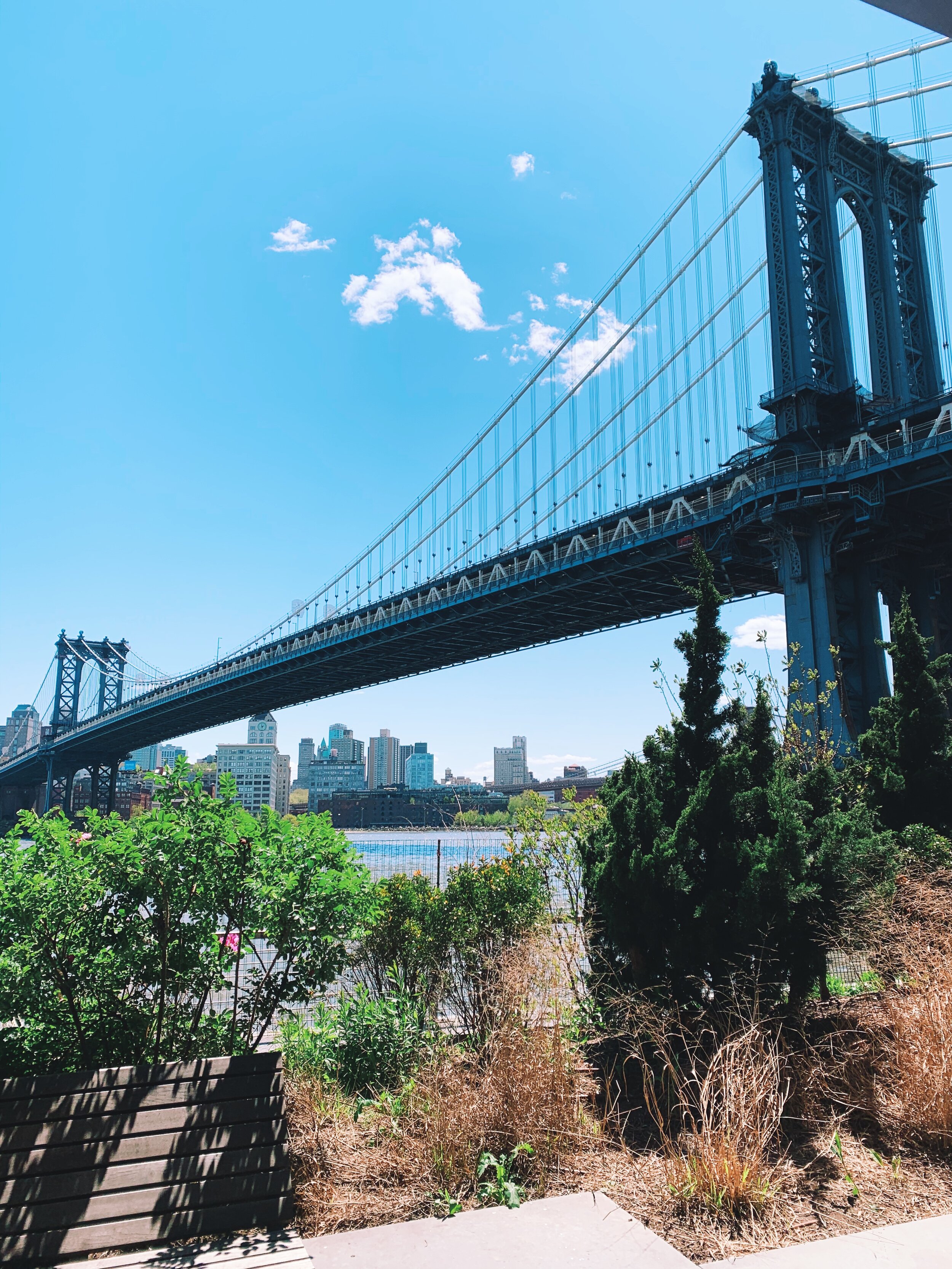
East River Path

East River towards Brooklyn

East River Running Route. (3-7 miles)
Central Park
Rolling hills, grassy fields, gardens, a zoo. Sometimes Central Park seems to barely be a part of the urban community it’s at the center of.
There are many different roads through Central Park. Some dirt paths wind through the grass and trees. Others carry two way traffic, cutting from East to West. My favorite is to loop around the reservoir. The most challenging routes are in the northern end of the park, where you’ll find the Harlem Hills.

Central Park Reservoir

Central Park South

Central Park Running Route. (4-7 miles)
West Side - Hudson River Run
The path along the West Side is so scenic. Miles and miles of clear path, overlooking the Hudson River, with a cool breeze.

There is an expansive path along the West Side

Views of the Hudson River

West Side Highway Run. (5-8 miles)
Manhattan South Loop
This is a longer route, but one that I love. There is so much to see as you run south past Two Bridges and into Battery Park. Aside from all of Downtown Manhattan you’ll also enjoy views of Dumbo, Bowling Green, the Statue of Liberty, and Ellis Island.

View from Two Bridges
Manhattan Bridge

The path along the West Side Highway.
It’s also excellent for biking!

Southern Manhattan Loop. (9-11 miles)
Brooklyn Bridges Run
This is a long route, with many extensions to add length. This is also obviously a run with elevation, more than the flat paths that outline Manhattan. I tackled this on a warm Saturday morning, and though it took a long time to complete, I was amazed by how much road I had covered.
It actually went by faster than I would’ve thought, as I had not completely mapped out the path beforehand, and was planning some as I went.
Create a good long playlist for this one!

Brooklyn Bridge Path

Brooklyn Bridges Run - Manhattan to make it shorter, Brooklyn Bridge to make it longer. (10-13 miles)